Trump Shares Altered Map Depicting Canada, Greenland and Venezuela as U.S. Territories
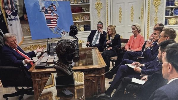
U.S. President Donald Trump posted an altered image on his social media platform showing a map that depicted Greenland, Canada, and Venezuela as territories of the United States. The image appears to be AI-generated and was shared alongside photos of Trump meeting European leaders in the Oval Office, with the doctored map visible in the background. Trump’s posts come amid his renewed push to assert U.S. claims over Greenland, which belongs to Denmark, arguing the island is critical for national and global security. He also shared a separate image showing himself, Vice President J.D. Vance, and Secretary of State Marco Rubio planting a U.S. flag in Greenland, marked “U.S. Territory Est. 2026.” These posts have sparked international scrutiny, especially among NATO allies, as well as debate over territorial ambitions and geopolitical strategy. Trump said he discussed Greenland with NATO’s Secretary General and expressed that there is “no going back” on his position


